3D Laser Mapping specialises in high-specification laser scanning systems for monitoring mine safety and activity. The company’s fixed and mobile laser systems provide a continuous electronic eye to automatically monitor mines 24 hours a day. The systems provide significant improvements in mine safety and automatically map and measure production. A live, online reporting capability provides remote support and monitoring from anywhere in the world via the Internet.
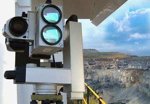
Long-range mine laser scanners
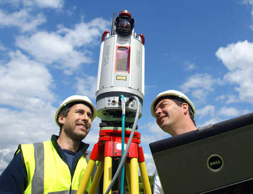
With specifications that other monitoring techniques cannot achieve, laser scanning opens up a whole new dimension in monitoring. 3D Laser Mapping employs the latest long-range laser scanners, which can capture up to 11,000 point measurements per second, to an accuracy of 10mm and at a range of up to 6,000m.
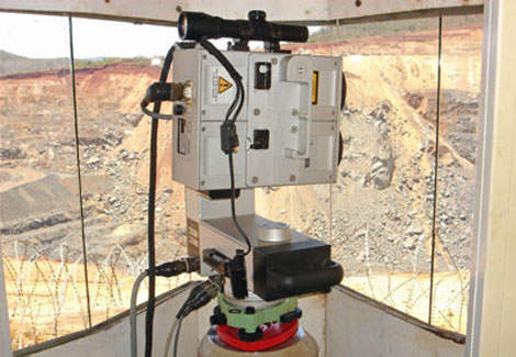
Fixed mine laser-scanning system
3D Laser Mapping’s SiteMonitor fixed laser-scanning system is designed to measure and monitor the stability of rock faces and slopes to improve mine safety. An Internet reporting service allows operations to be remotely monitored in real time from any location in the world.
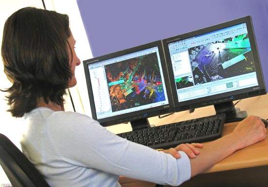
SiteMonitor also monitors and helps optimise production by generating a digital terrain map of the mine that can be used to continually measure extraction or fill rates and volumes. An analysis module allows data analysis and interpretation, including 3D viewing, automated cross-section production and the graphical display of measurements over a set time period.
Mine safety monitoring equipment
3D Laser Mapping’s range of mine safety monitoring equipment includes SiteMonitor analysis software, which tracks and compares displacement measurements over time. It features an alarm module that can be programmed to monitor recordings for unexpected or unusual measurements. This provides an early warning of abnormal movement and therefore potential failures in the active mining area that may impact on production, cause damage to equipment or even cause injury to personnel.
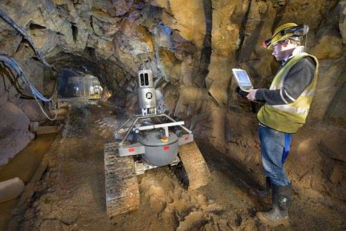
3D mapping technology – mobile, fixed and airborne laser systems
3D Laser Mapping offers a range of mobile, fixed and airborne laser systems that can be used for site surveys, perimeter security, research and exploration. 3D Laser Mapping has, for example, developed an innovative remote-controlled laser mapping vehicle called 3DR1 for use underground where mine entry is unsafe.
Global support for mine safety monitoring laser-scanning systems
Through a worldwide network of distributors 3D Laser Mapping is able to provide frontline support and service for a growing international client base. Using the internet-based support option SiteMonitor data is already being continuously streamed from gold, platinum and diamond mines in Africa to 3D Laser Mapping’s global operations centre in Nottingham, UK.